Point Cloud Surveying and Scanning
Point Cloud Surveying for Architecture | SOUP Architects
Learn the benefits of point cloud laser scanning for architectural projects, including improved accuracy, faster design, and better coordination.
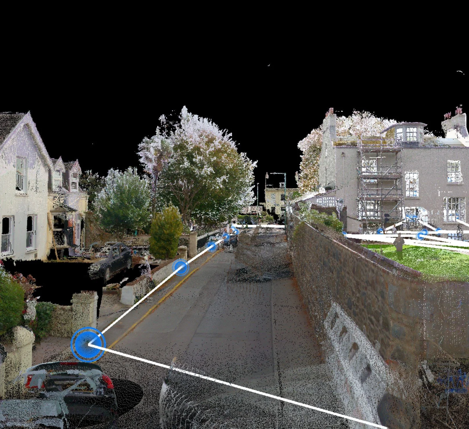
Point cloud surveying, typically delivered via laser scanning, has become one of the most effective ways to capture existing buildings and sites. Rather than relying on selective tape measures, photographs, and assumptions, a scanner records millions of accurate 3D points that collectively form a measurable digital record of the environment.
For refurbishment, complex geometry, tight tolerances, or multi-disciplinary coordination, point clouds reduce uncertainty and accelerate decision-making. At SOUP, we routinely use point cloud surveying on applicable projects to establish an accurate base for design and delivery.
What is a point cloud?
A point cloud is a dense set of spatial coordinates captured by a laser scanner. Each point represents a location on a surface such as walls, floors, roofs, structure, and often visible services, sometimes with colour imagery layered on top. The result is a navigable 3D dataset that can be measured, sliced, and referenced throughout design and construction.
The main advantages:
1) Measurable accuracy you can trust
Traditional surveys often combine spot measurements and interpolation. A point cloud provides comprehensive coverage, meaning dimensions can be checked anywhere after the survey without repeated site visits. This is particularly valuable for older buildings where little is truly square, and for projects where junctions must align precisely.
2) Fewer assumptions, fewer surprises
Many issues on existing buildings arise from what is not fully understood until work starts. Point clouds reduce unknowns by capturing the true geometry as it exists, not as it is assumed. This can reduce redesign cycles, RFIs, and costly corrections once setting out begins.
3) Faster design progression
A high-quality scan speeds up early-stage design because key constraints become clear immediately, including head heights, levels, structural depths, and datum mismatches. Internally, it also reduces time spent resolving uncertain survey information, allowing more time for design and option testing.
4) Better consultant coordination
Point clouds provide a robust baseline for structural and MEP design, cost planning, and buildability reviews. When everyone references the same measured dataset, coordination becomes simpler, quicker, and more reliable, particularly where services, structure, and fabric must coexist within tight tolerances.
5) Clearer communication
Point clouds help clients and stakeholders understand existing conditions quickly and accurately. They support feasibility discussions, de-risk approvals, including heritage-sensitive contexts, and improve contractor briefing by reducing interpretation.
6) Reduced site disruption
Scanning is fast and can minimise disruption compared to repeated measuring visits, useful where access is limited, occupants are present, or the building remains operational.
At SOUP we use point clouds as a practical project foundation: accurate capture, reliable registration, and direct integration into our 3D workflow so the dataset becomes the reference for design development, coordination, and measured outputs. This approach reduces uncertainty early, improves collaboration, and supports better decisions as the design progresses.